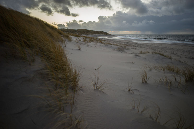
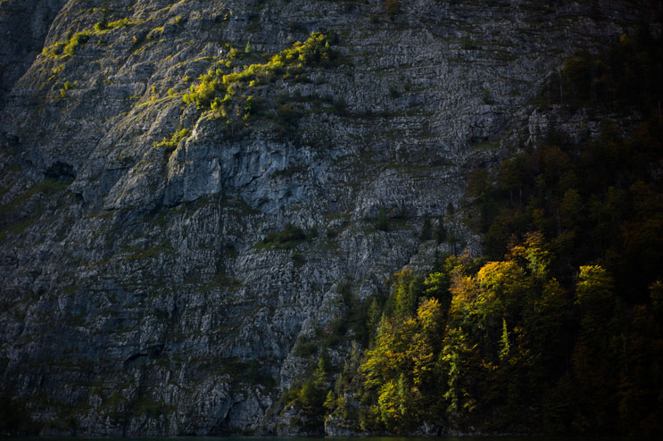
At the beginning of this month, Beth and I went to the North Sea island Sylt to photograph for a project that will run in the Süddeutsche Zeitung shortly. Sylt is part of the Schleswig-Holstein Wadden Sea National Park, an extremely shallow strait between the German mainland and a group of islands in the North Sea. During low tide, it empties out almost completely. It is home to a plethora of rare birds and other endangered animals. Sylt itself is shaped by the relentless wind that blows in from the sea. Its entire geography, flora and fauna have adjusted to this never-ending force of nature. We only had one day, most of which was spent shooting for the paper, but once we were done we had a couple of hours to explore. Here are some of my favorite shots:

Low tide is setting in on the eastern shore of Southern Sylt. Wednesday, December 4, 2013.

We walked a little way into the tidelands - I really enjoyed the texture of the ground there. I wish we would have had more time to go on an actual guided tideland hike. Maybe next time...

The trail winds through a forest on the southern part of Sylt. With all the leaves gone, the trees look almost skeletal.

Beth hikes up the crest of a dune in southern Sylt.

Hiking through the dunes on the Southern part of Sylt.

A patch of moss grows in the dunes.

Someone put up this little piece of art or whatever it is on the northernmost tip of Sylt (and thus of Germany). I'm pretty sure the wind has also had its part in shaping it over time.

We drove as far as we could to the northernmost part of the island (the so-called "Elbow"), then hiked through the dunes to the shore just so we could say that we were on the northern tip of Germany. Storm "Xaver" was already blowing in. 24 hours later it shut down the whole place and going to this particular spot would have been a very bad idea.

Somehow, despite the storm, we managed to prop the camera up on top of that piece of art you saw earlier and take a self-portrait right there at the end of Germany.
December 17, 2013
Alright, here’s a short one with some pictures from two trips to Königssee National Park in Bavaria that we did this fall. The first one was THE trip to Königssee – the one where I proposed to Beth. The second one was a week later with our friends Jen and Justin who came visiting from St. Louis.

This little cove at Obersee, a smaller lake just southeast of Königssee, is where I asked Beth - right under that tree... This is literally the last corner of Germany. Everything around us here is already Austria. Sunday, September 30, 2012.

Jen is looking out the window of the tour boat on our way to the south end of the lake. Saturday, October 6, 2012.

The sun breaks through the clouds over the Watzmann family on the western shore of lake Königssee. Saturday, October 6, 2012.

The tour guide blows a trumpet into the famous "Echo Wall," a rock face on the Western shore reflecting sound multiple times. Saturday, October 6, 2012.

Sunlight caresses the rocks on the western shore just above St. Bartholomew's. Saturday, October 6, 2012.

The sun sets behind the Watzmann massive. Saturday, October 6, 2012.

The mountains surrounding lake Obersee reflect on the perfectly still surface of the deep blue water. Sunday, September 30, 2012.

The view east over lake Obersee. The horseshoe-shaped valley is the last corner of Germany, beyond the mountains lies Austria. Sunday, September 30, 2012.
December 7, 2012
I realize that I still owe the pictures from Calin’s wedding, and so much more, and that I haven’t blogged in almost a month. It’s been a crazy summer and I barely had time to get the stuff done that I needed to do. My paperwork is piling up on my desk and my dirty laundry underneath it (my desk, I mean). The house is a mess, and I don’t even remember when I answered my last email. The good news is, we did have time last weekend for an amazing barbecue of slowly smoked ribs and tenderloin by the one and only Raymond J. Suda that blew my family and me away and once and for all redefined what we know as barbecue. Also, we managed to squeeze in a short trip to our beloved Island of Elba with Beth’s parents. Here are some shots from my cell phone:


August 21, 2012
As I discovered new parts of my beloved island that I hadn’t seen previously on our hikes with Beth, Flo and Corinna (see also my post from yesterday), I played around more with panoramas. I’m trying to get a grip on this technique, as it massively distorts the scenery in front of you. Apart from getting a uniform exposure over the entire panorama, I’m also trying to figure out how to play with background and foreground as well as depth of field. Below are some of the ones I liked. Click the pictures to view them large (the large files are downsampled to 3,000 pixels on the long side. The originals are up to 30,000 pixels).

View from the patio to Porto Azzurro; approximately 270 degrees. Monday, May 14, 2012.

On the Percorso del Monserrato, Porto Azzurro; full 360 degrees. Wednesday, May 16, 2012.

On the Percorso del Monserrato, Porto Azzurro; full 360 degrees. Wednesday, May 16, 2012.

On Monte Perrone, Marciana; approximately 270 degrees. Friday, May 18, 2012.

On Monte Strega, Rio nell'Elba; full 360 degrees. Monday, May 21, 2012.

On L'Aquila, Marciana; full 360 degrees. Friday, May 18, 2012 (Happy birthday, Beth!).
June 4, 2012


